Monthly Archives: July 2024

Eco-ing Seattle, Phase 6

When we last visited the Blender model I’m making of an alternative eco-Seattle loosely based on Kev Polk’s Edenicity ideas…  (If you want, you can start at Phase 1)

Overview of the whole town area in a 3D model with each village and its associated farmland marked with different colors.

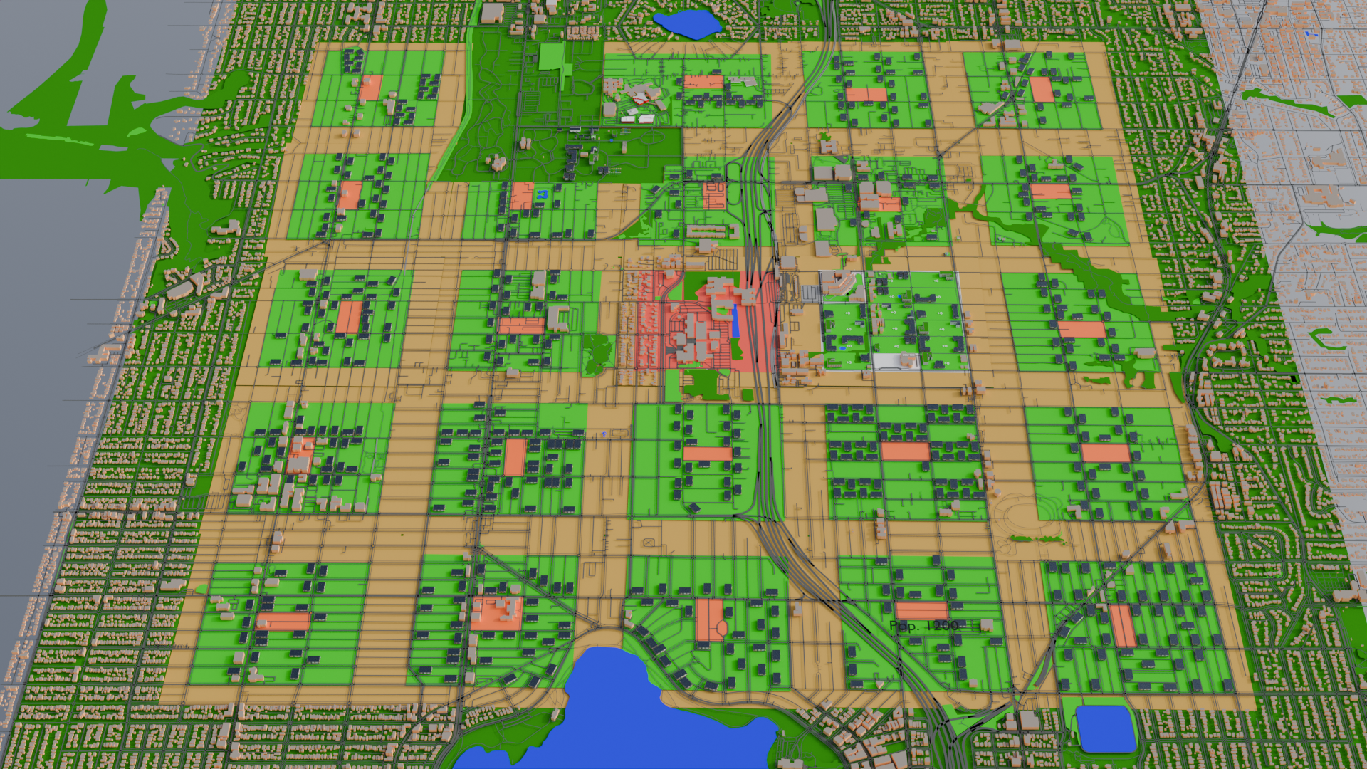
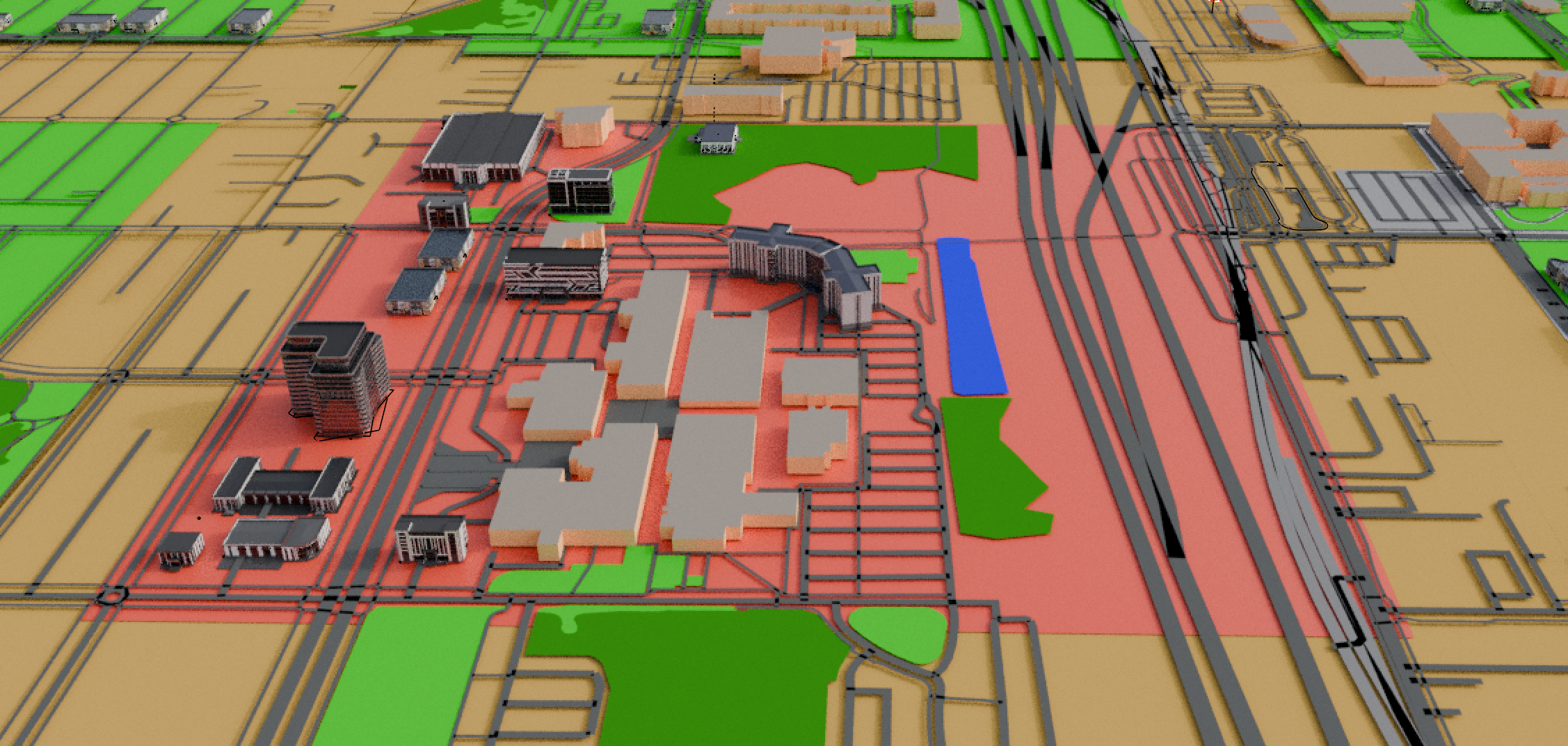
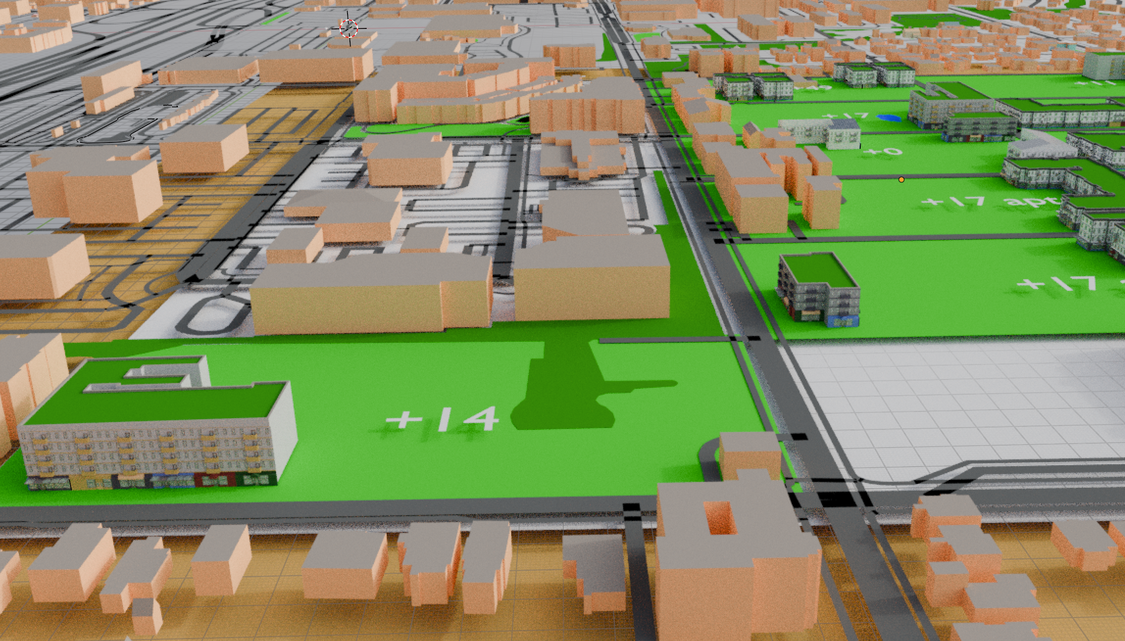
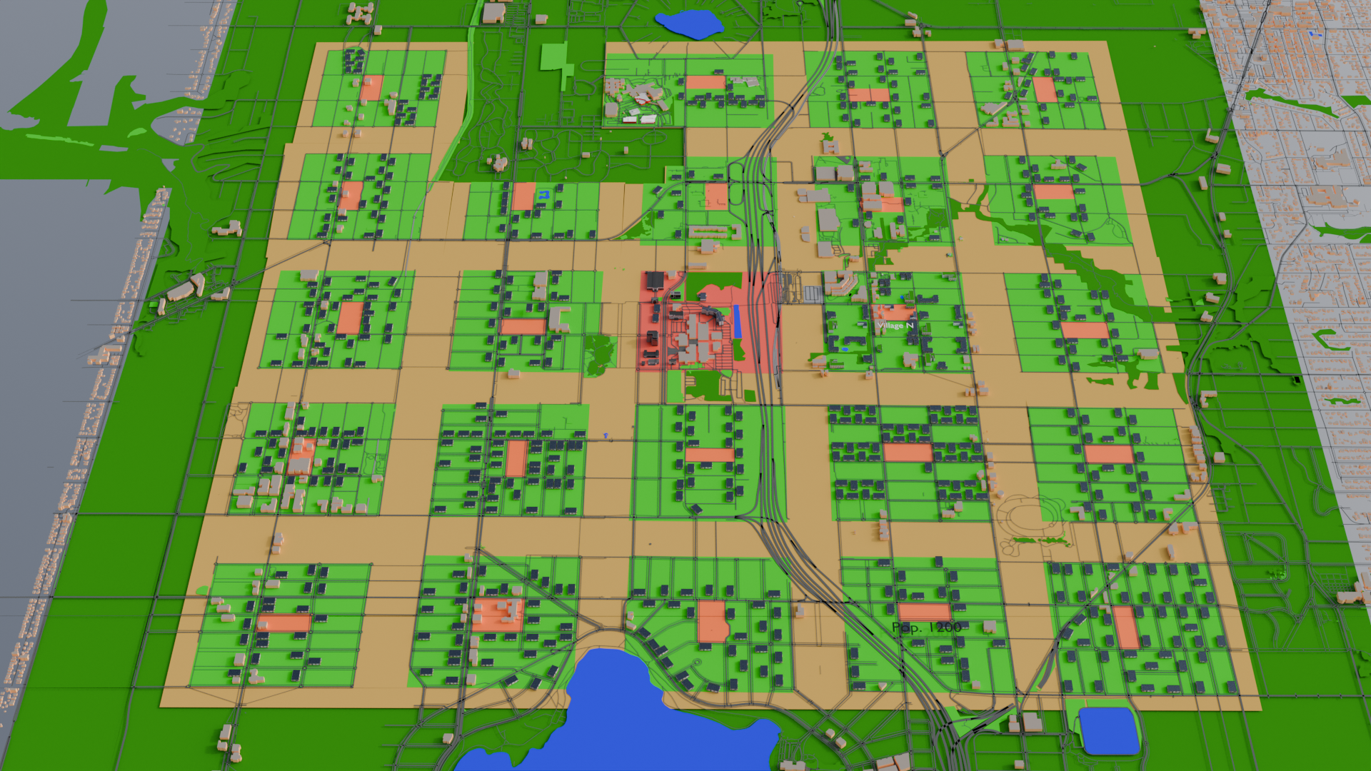
Today we look at that wide band on dark green around the town area in north Seattle.  The town center is the red area in the middle, where North Seattle College is.  Directly to the northeast is Northgate Mall, and the light rail and bus hubs are at the corner where they come together.

Now that you’re re-oriented, some measurements.  Each village (the 24 green squares) are approximately 625 meters  to a side (not quite 0.4 miles), adjusted to fit the nearest roads.  If you add the band of farmland around each–dividing each band in half so the villages on each side gets a farm–a village is 800 meters on a side (0.5 miles).  That means the whole town is 4000 meters–just shy of 2.5 miles–on a side.  Put another way, it’s less than a half marathon to run all the way around.  It’s still of a scale that’s comprehensible to many pedestrians, hikers, joggers, and others who aren’t always in their car.

(As a kid, our nearest grocery store and the library were a mile away.  Sometimes my friends and I would walk up to the store to get some candy or a book or something and walk back.  That’s what walking to the other side of this town would be like.  Literally child’s play for the able bodied.)

But what is beyond this?  The dark green band is 5000 meters on a side, or just about 3 miles.  Measuring from the edge of the farmland, the band is 500 meters deep.  That’s not quite a third of a mile.

Yes, yes, but what is it?!

Well, speaking of books and child’s play… it’s a deep, dark forest.  Well, it’s not that deep, and probably not too dark, but it’s a forest nonetheless.  It’s land that is re-wilded.  It’s hiking trails, and lakes for fishing.  It’s space to forage for mushrooms and berries.  For those into natural burials (i.e., returning to the earth without all the trappings of embalming fluid and casket fittings), there may be some areas set aside for people to “compost” themselves.  It could, in theory, also be a source of a small amount of sustainable wood for various uses, or have an area for trapping or hunting small game.  If the town council decides to allow those uses, of course.

In addition to direct human uses, this area would also help collect and filter rainwater before it makes it back to the Puget Sound, decreasing some flooding risk and decreasing water pollution.  Indeed, it would also ease the pressure on biodiversity, giving more species that are more sensitive to urbanization a place to live.

Dealing with the People

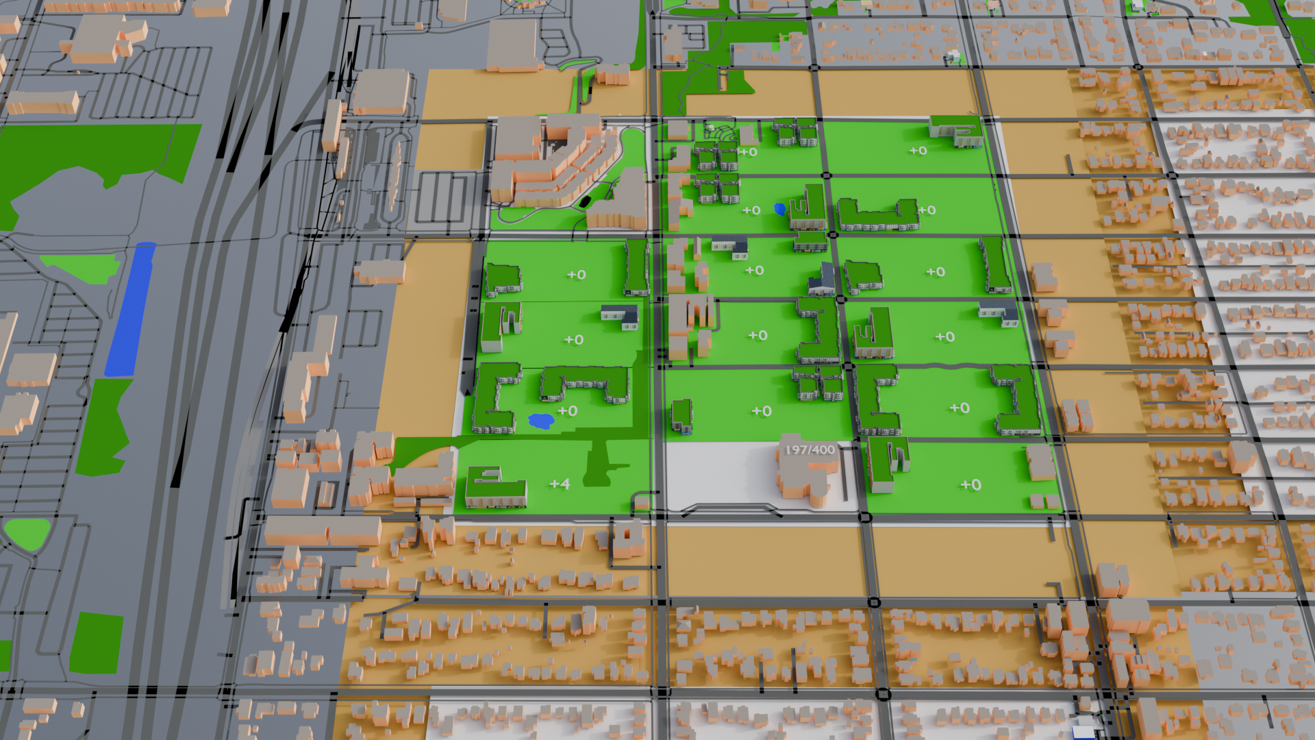
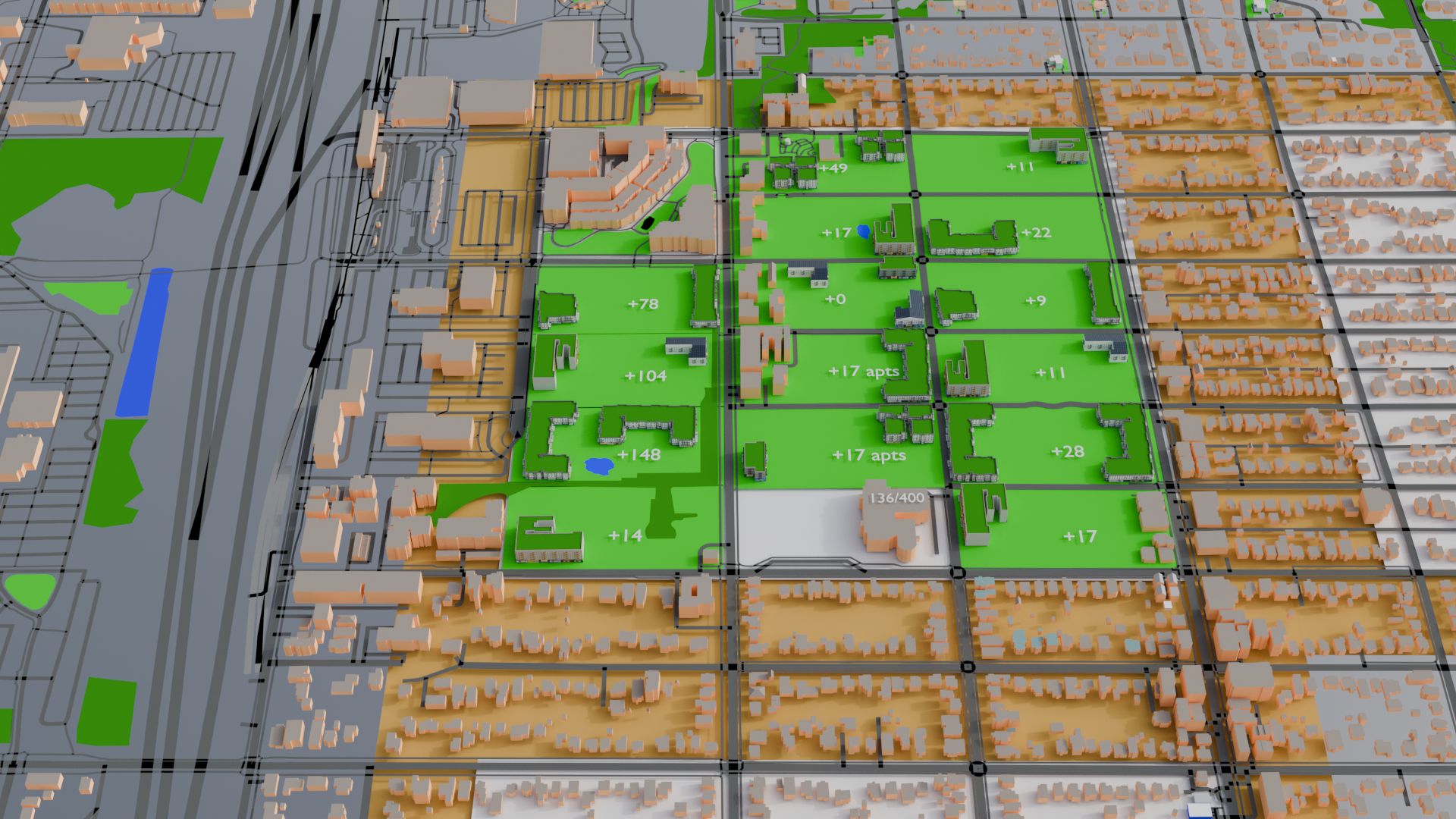
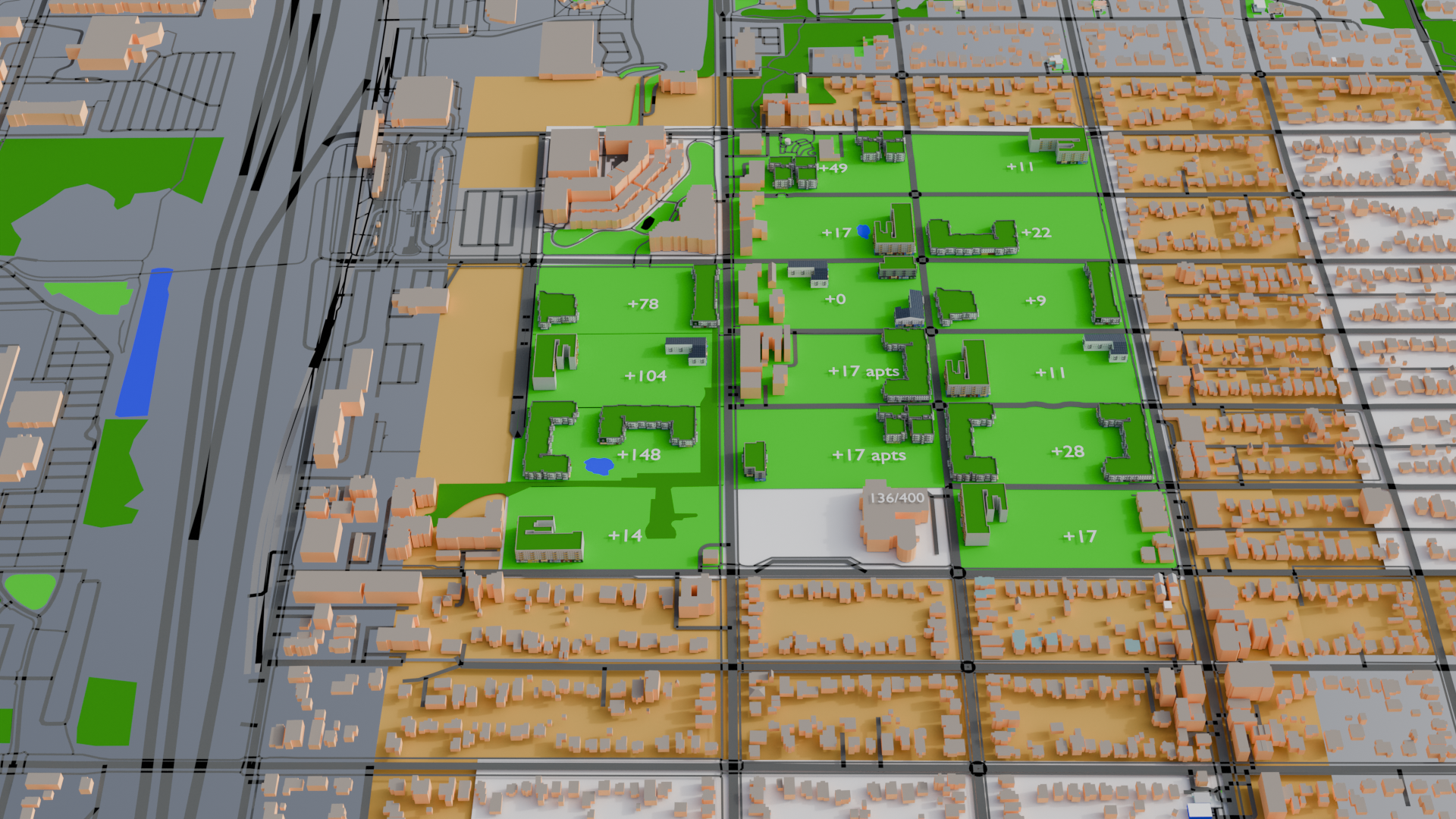
There we around 9,000 homes in the green band, or 18,000 individuals.  Given the housing assumptions from Phase 1, that’s 27,000 apartment equivalents.  Since the denser, Polk-style apartments I’ve used for most of the villages have 54 apartments (we’ll say 50 for easier math), that’s 540 apartment buildings, or 22 or 23 additional buildings per village.  That comes out to slightly more than one building per block.

The town model with virtually all the housing in the forest band removed.

To visually show them, and to provide a little variety, I made a new L-shaped apartment and put forest green on the roof to represent rooftop gardens again.  I had to do very little rearrangement of buildings to get 23 “forest people” buildings in each village.  One block couldn’t quite fit that many, so I put the few remaining ones in other villages. And since I built 23 in every village, that means there was excess housing of around 400 apartments, which could be dedicated to low-income or transitional housing to give more options for addressing homelessness.

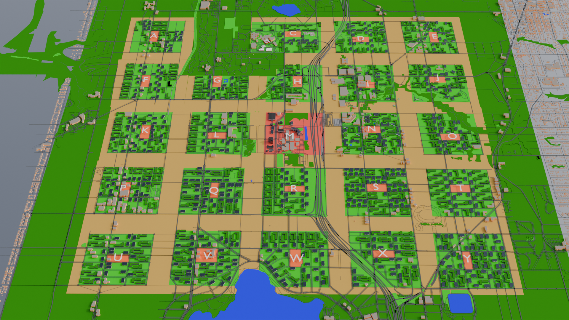
I continued to remove unnecessary roads passing through farmland, and lots of them in the forest.  And for good measure, I put a label for each village over the village center for easier reference.

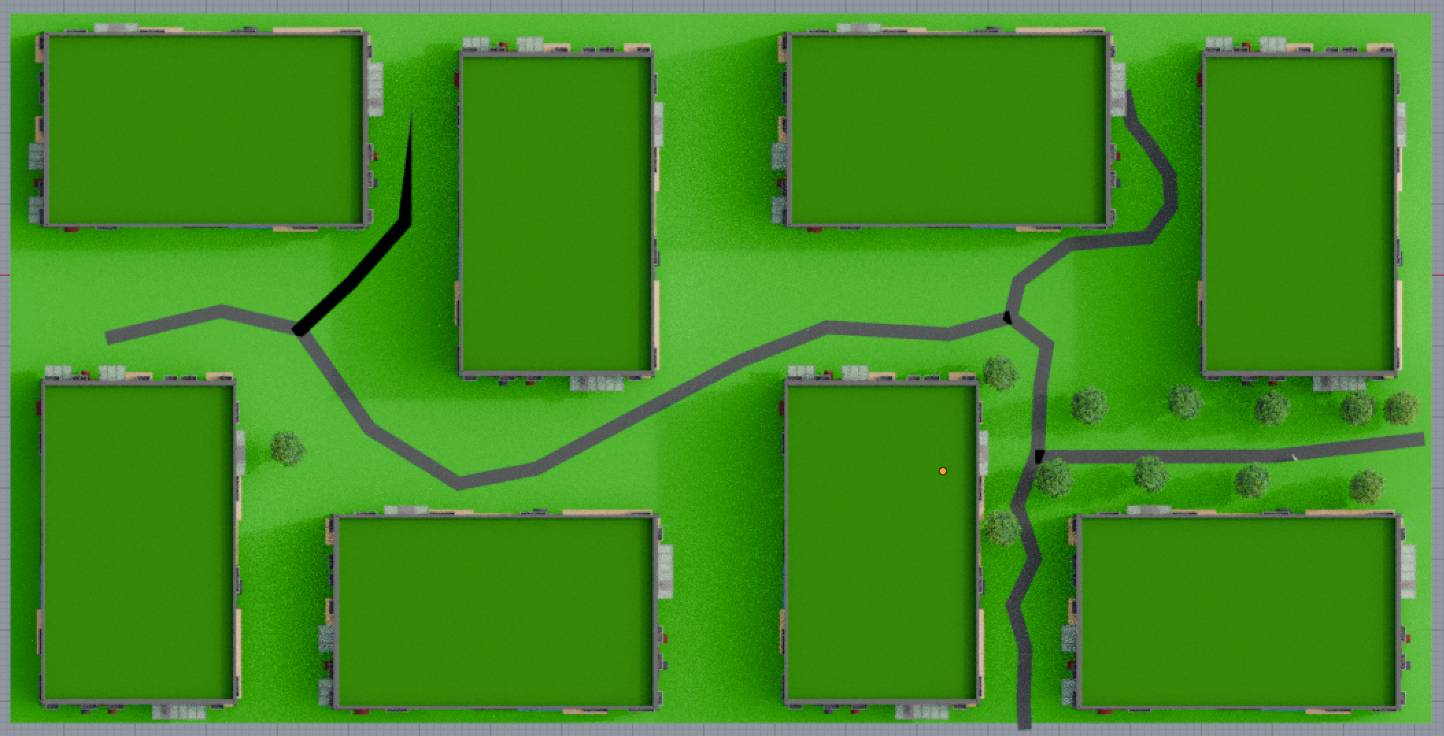
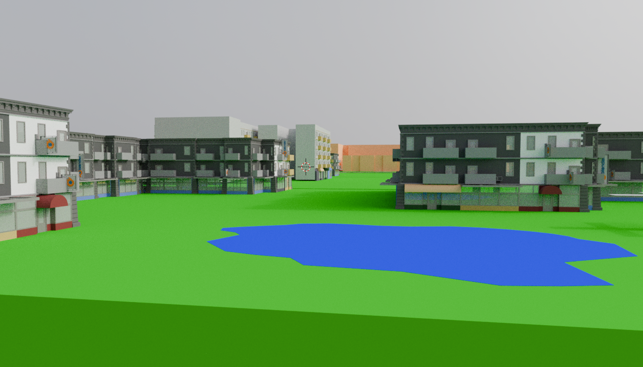
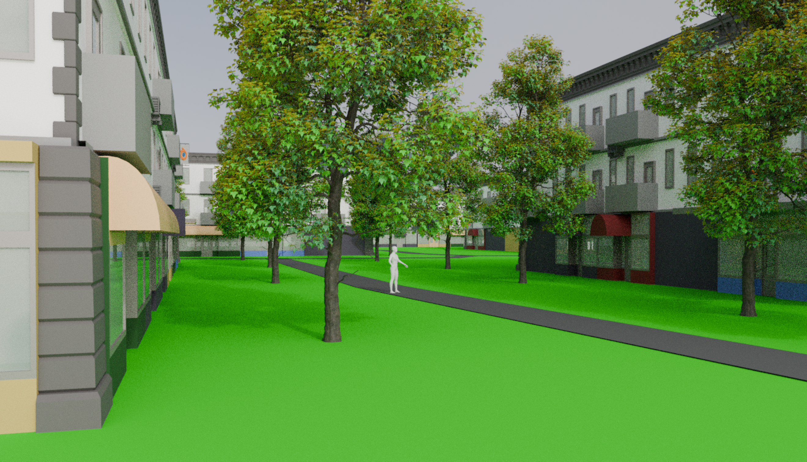
The villages are pretty dense, but all are still low rise residential. They’re all one floor of office/retail space, with two floors of housing.  The end.  A village could build higher in order to free up more park space if it wanted, but so far the only buildings taller than three floors are in the town center.

Town model with additional buildings in the villages to house the people that had lived in the now-forested regions.


In Summation…

The point is this:  all that farm land and all that forest land can be freed up if people live more densely, and the emphasis is put on zoning for pedestrians rather than cars.  I didn’t doubt that a city built from the ground up could be set up the way Polk’s Edenicity was, but I definitely wasn’t sure an existing city could convert.

However, it wouldn’t take much more than zoning changes to make this a reality.  In village areas, require that new construction be low-rise mixed-use.  In farm/forest areas, disallow such building and perhaps have some incentive for people or nonprofits to buy up land from those who want to sell and convert it to the new use.

Slowly, over time, policies like this would nudge the city toward what I’ve modeled here.  Not as fast as I’ve done it, of course, but based on the real estate numbers I found, most homeowners stay in a house less than 20 years, and most Seattle blocks have about 20 homes.  In other words, you could have a conversion rate of about one home into a new use per year.  A baby born this year could come home from college to this vision of Seattle:  a walkable, solar-powered place where most meals include food grown 3 blocks away, and where you can hang out in a forest by traveling less than 2 miles for everyone.

Oh, wait, wait, wait!  Another thought!

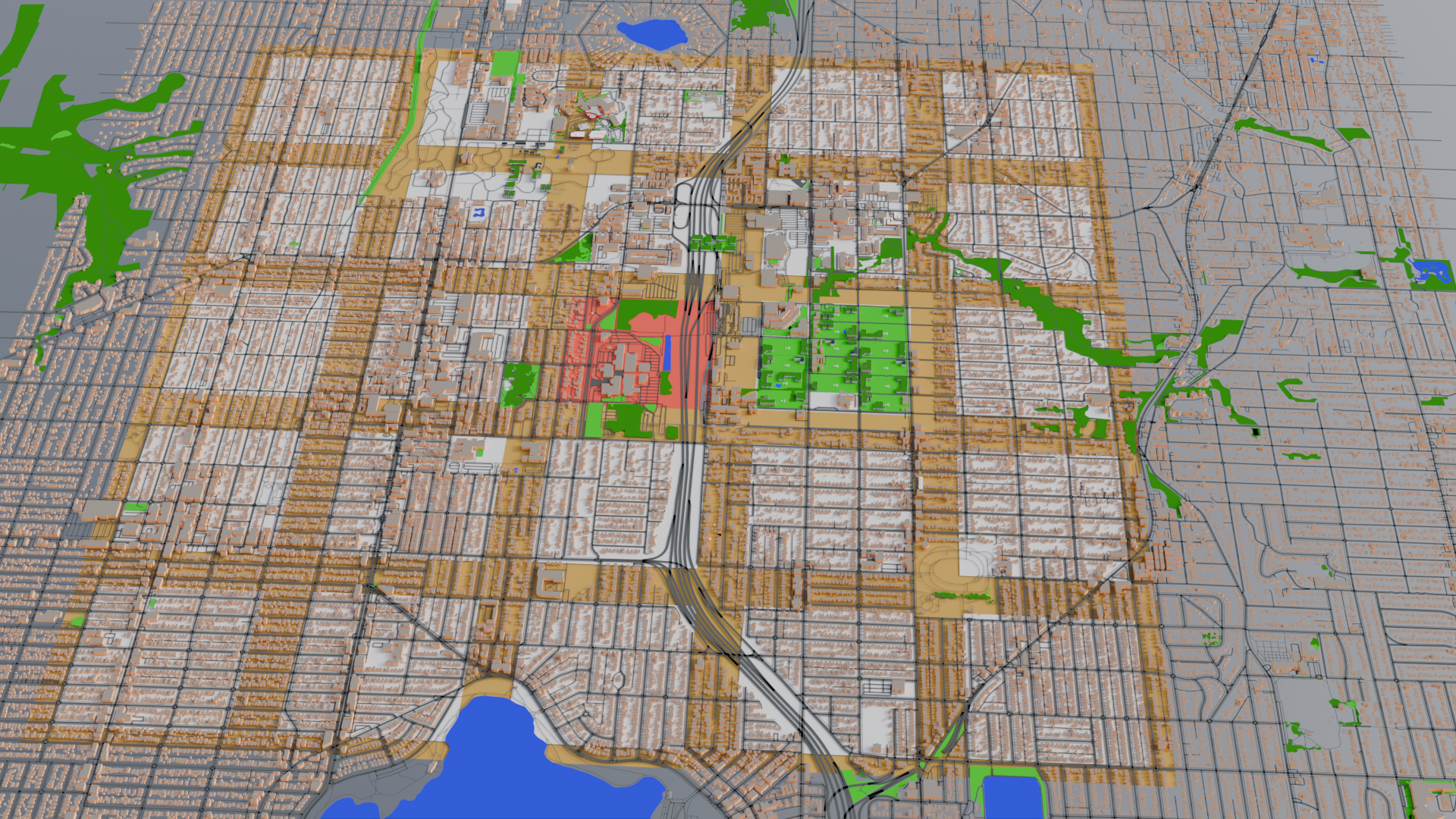
Looking back one last time at Polk’s Edenicity plans, he mentions that a town could house 150,000 people.  At the densities he uses, that totally works out with what I’ve done here.  Seattle’s population is just over 750,000 here in 2024.  Doin’ a little math and that would mean all of Seattle could fit in about 5 of these towns.

What would that look like?  I’ll show you:

Map of Seattle with five squares superimposed. There are two in north Seattle, a downtown square, a SODO square, and a West Seattle square.

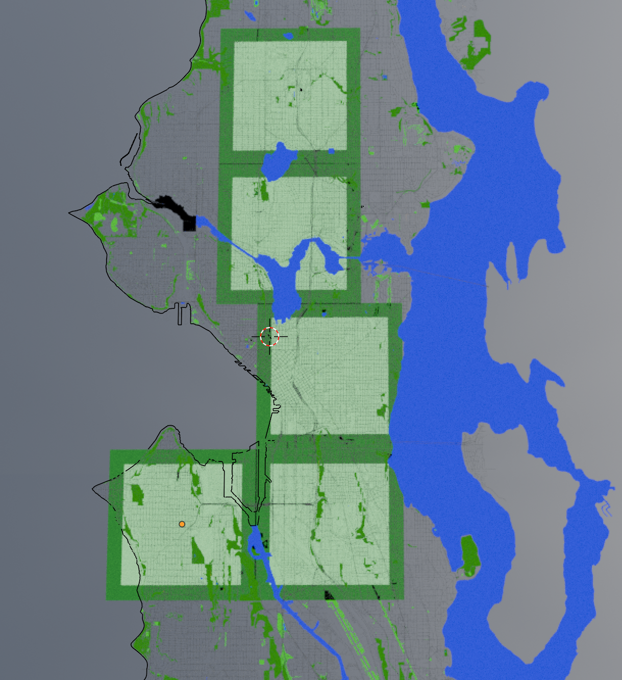
The top square is the town I just made.  Going south there’s a town for the U-district/Wallingford/Ballard/Fremont area, a Downtown/Capitol Hill town, a SODO/Central Valley/MLK town, and a West Seattle town.  All could get this same treatment.

Those living in the aftermath of red-zoning would no longer be in a food desert or suffering the worst of the heat island effect.  After all, a farm and a forest are mere blocks away.  Transit to the other towns are minutes away.

Some industrial zoning would need to be worked out, of course, as the town plans only included offices in the town centers.  And perhaps the Downtown-town could continue to specialize in extra-tall office space since it already has skyscrapers in place.  But a lot of Seattle’s industrial is already south of the two southernmost towns, and in that little triangular bit northwest of downtown.

Perhaps these aren’t the best places to put the towns. I don’t know.  I’m not an urban planner–I just play one in Blender.  But what this has shown me is that there is a lot of room to play with.

Imagine what could be done with the bulk of the land that isn’t in one of the villages.  Returned to nature?  Returned to descendants of the Native Americans whose land this was when Europeans took it?  Solar and wind farms for even more renewable energy?

Whatever it is, I like that the math works out.  This kind of a city is possible.  We just need to make choices that move in this direction.  Pass pedestrian- and bike-friendly traffic and road-building policies.  Lean into mixed-use buildings with community parks and away from fenced-off private yards.  Require new construction to include a solar or green roof.  De-emphasize single-occupancy cars in favor of a more robust bus-and-rail networks.

We can do it.


Leave a Comment

Filed under Uncategorized

Eco-ing Seattle, Phase 5

Previously, on Eco-ing Seattle…

In Phase 1, I took an 18-block space in Northgate and created what I’m now referring to as “Village N” by consolidating all the green space and converting single family homes into low-rise condos with more floor space on average for each person.  Phase 2 did a similar thing to small retail and office space, moving them into the ground floor of the new condos and apartments, and converting their huge parking lot area into community parks.  Phase 3 created a 1-block band of farmland around the village by moving those people and businesses into the excess spaces in the village area.  And then Phase 4 zoomed out to look at the larger context of the village as part of a larger collection of 24 villages as a “town” with a town center, and roads and transportation within the town.

Converting the Town

To make the entire town, I did what I’d done in Village N to all of the villages in the town-level organization, just with a bit more abstraction.  First, I defined areas and renamed them by letter, starting at Village A in the northwest corner, Village E in the northeast, Village M being the town center, and Villages U through Y along the southern border.

Then I estimated the population in single family homes (with a little bit of randomness skewed toward the high end added for good measure), gave each person 1.5 apartment-equivalents, left larger apartment buildings as they were, and built enough low rise mixed use apt/condo buildings as necessary to house everyone in the village and the farm band around it.

One thing I noticed as I did this was that each of these little micro-neighborhoods had quite a large variation in how many people lived there.  Some only ended up with an estimated population of a few hundred, others with over 2000–again, just looking at single-family residents.  This really had an impact on how many buildings I needed to add to each village.

A second thing I noticed was, well, the road grid was a lot more varied than it seemed at first.  Block sizes were generally the same throughout, but lots of places had the long side of the block going north/south, while others were oriented east/west.  There were lots of road that were not quite oriented to the compass directions, and some that just seemed to do whatever they wanted.  This opened up the idea for me of building placement preferences.

Overview of the whole town area in a 3D model with each village and its associated farmland marked with different colors.

As a result, I treated each village as if it had its own village council choosing where to put the buildings.  Many went with a strategy of prioritizing buildings along the larger roads, clustered around the village center, or a combination of both.  Some went with tight clusters of housing/business in order to maximize open space elsewhere in the village, while others went with an attempt at equidistant spacing so everyone had a similar amount of open space around the building where they lived.

I also adjusted the edges of each village slightly to match the road network.  This meant that some villages ended up with a somewhat higher ratio of farmland, while others somewhat less.  I also marked a block in reddish-orange near the center of each as the village center.  This, too, varied a little based on the block size, location of larger roads, and so forth.

And I had to eliminate Village B entirely, since it would have been built on top of a cemetery, a veteran’s memorial, and the grave of one of the people sometimes credited with discovering gold and triggering the Yukon Gold Rush.  Graves and some Seattle history probably shouldn’t knowingly have condos built on them.  (I’ve probably built other stuff on more graves unknowingly, but I’m not aiming for perfect–just a reasonable model.)

Once that was done, I decreased the width of the roads as described in Phase 4.  This has a slight effect of visually de-emphasizing roads, but I had still noticed that there were a lot of roads–particularly crisscrossing the farms.  That wouldn’t do, so I kept roads that defined edges of villages, and at least one connecting village centers for the bus system.  The rest of the roads through farmland were removed.  This should improve efficiency and ease of farming, and route cars through more defined areas.

Oh, and I changed the roof textures to solar panels rather than rooftop gardens.  No doubt if this were done in real life, there’d be some combination of both throughout the town.  but it made the buildings easier to see if everything wasn’t some shade of green.  Community gardens can happen at ground level, and more solar installations just make power more sustainable.

Town Center

I realized that I’d neglected the town center, which is in the location of Village M, marked in red in the center of the map.  That is currently the location of North Seattle College, which is well enough, but I’m going to be building some additional buildings.

Model of the town center with existing North Seattle College buildings in tan, and additional buildings both on and off campus in a square region of 625 meters on a side.

I started by moving the few houses into two apartment/condo buildings, which was more than enough housing for everyone.  I kept the buildings of North Seattle College the way they are now, but added more amenities appropriate to the idea that they’d serve a larger region than just this village.  I added another school building for under-18 students who need additional support or advanced programs, overflow students if a village school fills up, and so forth.

There’s an assembly hall for the meetings of the town council and others, located in the park at the north end.  Heading east from there is a wheelchair accessible pedestrian pathway leads over the freeway to the train and bus hubs.  This makes civic involvement more convenient and inclusive.

One block further on is a multiplex theater on the corner of Village N so that’s not really needed here.

I added a multistory medical center, a fairly large fire station, and multiple mid-rise office buildings (4 to 12 stories).  And a sports complex for, you know, sportsing.  Or whatever happens in one of those.  (Not my thing, don’t @ me.)

For those following along in Blender, all these new buildings were free models in BlenderKit, all of which can be found by searching the models category for “facade.”

Could there be a shopping complex here, too?  Yeah, probably, though most of the current Northgate Mall is located in Village I, which is about a 10 minute walk away, and this town center in particular has the freeway taking up almost a quarter of the space, so I figure that’s a good enough arrangement and shows how you don’t necessarily need to bulldoze everything and be perfectly and rigidly aligned with the Edenicity plan to have something far more human- and eco-friendly than this part of Seattle is now.

There’s still room to add more offices if office space is needed, or some low-rise office buildings could be sprinkled throughout the various village centers, too.

Coming Soon to an Eco-Seattle Near You…

So that’s the town.  We’ve got 24 park-like villages with safer and more areas that are walkable and bikeable.  The buildings have solar power to decrease reliance on the grid, and the villages are surrounded by midsize farms providing for a local source of different types of food.  And everyone’s a block or two from a bus stop that can take them to the town center, where there’s more shopping, offices for those with that sort of job, a hub of education, entertainment, and other civic services.

What more could you want?

Well, if you’ve been paying attention to the aerial views, you may have noticed a band of dark green around the town.  That’s what we tackle in Phase 6.

Leave a Comment

Filed under Uncategorized

Eco-ing Seattle, Phase 4

I know the transportation part of this is not going to be particularly visual.  If you saw Phase 1, you’ll know I imported a chunk of Seattle into Blender with Blosm.  It imports transportation information as 1-dimensional lines that have some width applied to them based on the type of road or path.  These uses/types of path are grouped into sometimes surprisingly fine divisions, like footway (sidewalk) vs. pedestrian area (car-free plaza or transit platform) vs pedestrian road (which I couldn’t find an example of) vs. stair steps.  If I combine and simplify, I get the following groups:

  • cycleway and footway (both 2m wide)
  • railway (6m wide)
  • carway
    • motorway–freeway, or regional distance travel (10m)
    • primary, secondary, and tertiary roads–generally used for in-town distance travel (9, 8, and 7m)
    • residential streets–usually two lanes or effectively one lane plus street parking (also 7m)
    • service roads–single-lane alleys and low-speed lanes in parking lots (4m)

With people and daily-needs businesses being closer together–indeed, often in the same building–there will be a drastic decrease in the need for driving a car lots of places.  Many car trips will simply vanish because to get groceries you might just have to cross the street, not travel a mile.

The need for cars can also be decreased with a detail from the original Edenicity plans by ensuring that the middle of each village area has a nice transit stop.  That means everyone lives less than 3 blocks from a bus stop.  And here, we need to zoom out.

In Edenicity, the villages are organized into larger groups called “towns,” made up of 24 villages and 1 village-sized “town center.”  In the image below, the town center is marked in red (the real-world location of North Seattle College.)  With everyone in each village close to their village bus stop, everyone is well serviced by transit using only 25 stops per town.  The idea being that you’d catch the bus and in just a few minutes you’d be at the town center.  There, you’d find larger-scale services like perhaps a hospital, some office buildings, and longer-distance transit.

An aerial view of the city. The previously shown village blocks indicated in green next to one in red (the town center), at the center of a 5x5 grid of villages surrounded by farm bands.

In my scenario here, people would bus to the college campus area.  The bus part of the transit hub is along the northwest corner of our first converted village, and the light rail connection at the corresponding northeast corner of the red town center area.  From there, anyone in this entire town can catch two types of public transportation to other parts of the city (ostensibly organized in a similar way).

All of this means transit becomes faster and more convenient for more people in this area than it is today, which also reduces the number of car trips.

With both fewer car trips needed for daily needs, and increased availability and speed of transit, the capacity of roads can be decreased.

Going back to the list at the beginning of this post, the existing paths for cycles, pedestrians, and rail are kept as they are for the time being.  However, the first three types of carways (freeway, primary/secondary/tertiary roads, and residential streets) get shifted down one level.  Freeway -> primary -> secondary -> tertiary -> residential -> service.  To use examples from this area, it would be I-5 -> Aurora or Northgate Way -> Greenwood or 85th or Greenlake Drive -> 80th St / 15th Ave NE -> residential and service roads.  In most cases, it’s shaving a meter off each type of road–slightly narrower lanes, or converting one of multiple lanes into green space.

The largest change would be tertiary and residential roads (7m wide) into service roads (4m wide).  These all become more human/pedestrian in feeling, though cars could still make their way through if needed.  Much like the experience of mixed pedestrians and cars in a current parking lot, both would be on more even footing with each other.

These changes aren’t very visible on the model, but on the ground would make everything seem just a bit safer with less car-frenzy.  The “loss” of 3 meters in tertiary/residential road width can mean conversion to bike lanes and footpaths, which by default are only 2 meters.  The primarily residential roads in the villages might look like a narrow, alley-sized local-access-only car road alongside a solar-panel covered, separated bike-and-pedestrian road.

The change also increases opportunities for those with mobility issues by reducing average car speeds, car volume, and the number of lanes that need to be crossed, and increased emphasis on pathways with no cars (bike and pedestrian).  No doubt there would still be occasional challenges depending on individual circumstance, but providing many more options improves life for everyone, not just drivers of single-occupancy vehicles to the exclusion of everyone else.

No doubt there would be knock-on health effects, too.  More people getting outside a little more often, a little less air pollution, some extra exercise…maybe even seeing and getting to know your neighbors for a bit of social cohesion.  But all that is more about behavioral choices than zoning and infrastructure, so I won’t spend too much time on that.

A note about density

In the previous phases of this experiment, I wanted to see if you really could replace all those blocks of single family homes with park and farm land as Polk set out in Edenicity.  Using the averages as assumptions described in Phase 1 you totally can.  It frees up a lot of space if people are in higher density housing and private gated lawns are turned into public community areas.  However, Polk’s arrangement is even more dense than mine.

That first village that I modeled has a population of somewhere between 1500 and 2000 people, or about 100 apartment equivalents per block, give or take.  As a reminder, when the housing is at capacity it looks roughly like this.

3D render of the village with just the southwestern block of the farm band with houses on it. The blocks in the village proper are all labeled +0 to show they are at capacity except for one labeled +4.

That’s usually two reasonably large apartment or condo buildings on each block.  Some of the buildings I used there are four floors of residential with ground floor retail.  Apparently three floors total (retail+2 residential) is considered low-rise, while 4 to 12 floors is considered mid-rise.  I’ve used a mix of both in this first village.  In the original Edenicity plan, though, Polk opted for more buildings but keeping everything low-rise.  One of his default blocks is set up like this:

A top view of a 2x1 ratio city block with 8 buildings. Each half of the block has four buildings arranged in a kind of pinwheel formation, and the ground between has pleasantly meandering paths like a park.

This block, continuing to use my previous assumptions would be 432 apartment equivalents.  (Remember, my assumptions give 1.5 apartment equivalents to each resident of single family homes that get converted, and each apartment equivalent is about 25% larger than the current average Seattle apartment, so everyone’s still getting more space in their home than they had before.)  These 8 condo/apt buildings would house the equivalent population as 144 single family homes.

So far so good, but what is it like outside the buildings?  A very quick look from ground level, looking north from the block in the southwest corner of the first village in my model with fewer buildings.  I haven’t added trees or any park landscaping, but you can get a sense of scale with the buildings and locate the pond on the larger views of the village.

Street-level view of 3D model. It includes wide open space in grass green and some forest green, a pond, and dotted with several buildings of 3 and 4 stories.

And for comparison, Polk’s denser version from ground level.  In this case, I did add some trees and a blank human figure for scale.  To me it feels kind of like a grassier version of Seattle’s Pioneer Square in terms of density.   Still pleasantly spacious, but definitely more urban.

3D model from street-level view. There are more buildings in view than the previous image, but the path and trees still give it a city-park feel.

This still feels better to me than most city blocks in Seattle to me.  For efficiency, I’ll keep my first village as-is, but base the blocks of the rest of the villages on this layout.  The modeling of the initial village helps me know that this level of density isn’t needed yet in terms of housing everyone, so I’ll fill up buildings as I need them.

Next stop:  the entire converted town with all these transportation and building changes in place.  (If this were a video, the sped-up footage of me converting 23 more villages would play…)


Leave a Comment

Filed under Uncategorized

Eco-ing Seattle, Phase 3

In Phase 1 and Phase 2, the zoning changes I assumed allowed me to consolidate green space in this first “village” just south of Seattle’s Northgate Mall and just west of the Northgate Transit Center.  That resulted in more than enough new retail space to clear out a couple blocks of office park or strip mall and its excess parking.  When we were done, the map looked like this:

The village 3D model with 17 of 18 blocks covered in green space and higher density mixed-use buildings. The last block is the school showing 136 of 400 possible students enrolled.In this phase, we’ll be looking at the golden band around the village.  Note that I’ve roughed out another village area to the south and east, each of which has an abutting band, but these should be considered separate–each band “belongs” to the village it surrounds, extending roughly 300 ft or 87m beyond the edges of the village (or the distance of the short side of a block).  This is the farm band, where more medium-scale farmers can grow crops like grains, beans, peas, or some livestock pasture land on a commercial basis.

In order to plant in the farm band, a lot of buildings and parking spaces need to be removed.  I started on the western edge because there were still some of those commercial or office buildings that could move into the new spaces created in Phase 2.  I did keep one patch of parking in the northwestern part because it was right next to the existing transit center.  Roads still need to be addressed, and I’m not going to be entirely eliminating cars or anything.  If this transit area has easy access to dozens of bus routes and the light rail line through the city, keeping a way to access cars as well made sense.

Computer generated 3D model of the area showing buildings and parking removed from much of the northwestern part of the farm band around the village. It is marked with a golden yellow-brown color similar to that of mature wheat.

Unfortunately, that was the easiest part and only frees up only about a quarter, or maybe a third of our farm land.  The rest of that zone is still covered with single family homes and some apartments.  We’ll continue clockwise around the farm band and move people into the excess housing in the village.  As before, each single family home is converted into 2 people who each get allocated 1.5 apartment or condo equivalents, and 20% of the people are assumed to be school age and enrolled in the school on the southern edge of the village (see the Phase 1 post if you want to see the math on all that).  Because I’m getting more bang for my buck that way, I’m removing single family homes first and will leave any higher-density apartments where they are for the moment.

As shown in the image below, the excess housing in the village could nearly absorb all the single family houses in the farm band.  A single block of houses, and a couple of small apartment buildings remain in the farm band when the current village housing hits capacity.

3D render of the village with just the southwestern block of the farm band with houses on it. The blocks in the village proper are all labeled +0 to show they are at capacity except for one labeled +4.

Building one additional larger or mid-rise condo building in the village, or two smaller low-rise buildings, will be enough to accommodate the remaining houses in the farm band.  I’ll opt for the latter for a little variety, and the farmers can get to work.   And every resident of the village is no more than about two blocks from farmland, in addition to having a park just outside the building they live in.

In the next phase, I’ll tackle transportation.


Leave a Comment

Filed under Uncategorized

Eco-ing Seattle, Phase 2

In the last… devlog?   Post in this series?  I discussed Phase 1 of my playing around with some city design ideas to make a more ecologically-based, healthier city.  In Phase 2, I’m doing more jiggering to my 3D model of this “village” near Northgate in Seattle.  The residents in Village 01 have been shuffled around so everyone has more nature available for their enjoyment, as well as more square footage to live in (though at the expense of private yards for homeowners).

And I should stress that this is all experimental on my part.  I’m just taking some of the ideas mentioned previously and seeing what they might look like if applied to a real place using essentially nothing more than zoning and similar city-policy sorts of tools.

One of the changes I didn’t talk much about was that the first floor of each new low-rise apartment/condo building was retail/office space.  There were also three blocks’ worth of strip mall/office park (and tons of parking lot that usually goes mostly unused).  Comparing square footage of the mixed-use  retail space in the residential buildings with the strip mall shows the new retail space is almost double what’s available in the strip mall.

A view of the 3D neighborhood model featuring a couple of the mixed-use apartment buildings with retail, and the two blocks of office park or strip mall.

So guess what?  Bulldoze the strip mall!  All the businesses in those couple of blocks can move into the brand new storefronts in the other blocks of the village and still there will be room for more.  The businesses in this office park area include several school or tutoring businesses, a couple of medical related organizations (clinic, lab, allergy center, pharmacy, etc.), bank, gym, and some spiritual or alternative health places.  Not everything you need on a regular basis, but the other storefronts could easily host a small grocer for fresh produce, a few cafes and restaurants and a nice neighborhood bar or two, maybe a daycare for humans and another for pets, a library, and other shops and services.

That leaves three blocks of nothing but parking.  Transportation will get some attention in the future, but with so many daily needs now within a couple of blocks of each resident, three full blocks dedicated to parking isn’t really needed.  This area will get redeveloped into three more housing-and-park blocks.  Of course, this adds back in space for even more businesses (almost half of what had been here before) and residential (+330 apartments/condos), in addition to park/garden space.   Now the village looks like this, with numbers indicating open housing space (see Phase 1 for assumptions about housing).

The village 3D model with 17 of 18 blocks covered in green space and higher density mixed-use buildings. The last block is the school showing 136 of 400 possible students enrolled.

At this point, the village has lots of greenery, quite a few vacancies, and an excess of retail space.  In the next post, Phase 3 will address those vacancies, and look at the golden band surrounding the village.

Leave a Comment

Filed under Uncategorized