
In Phase 1 and Phase 2, the zoning changes I assumed allowed me to consolidate green space in this first “village” just south of Seattle’s Northgate Mall and just west of the Northgate Transit Center. That resulted in more than enough new retail space to clear out a couple blocks of office park or strip mall and its excess parking. When we were done, the map looked like this:
 In this phase, we’ll be looking at the golden band around the village. Note that I’ve roughed out another village area to the south and east, each of which has an abutting band, but these should be considered separate–each band “belongs” to the village it surrounds, extending roughly 300 ft or 87m beyond the edges of the village (or the distance of the short side of a block). This is the farm band, where more medium-scale farmers can grow crops like grains, beans, peas, or some livestock pasture land on a commercial basis.
In order to plant in the farm band, a lot of buildings and parking spaces need to be removed. I started on the western edge because there were still some of those commercial or office buildings that could move into the new spaces created in Phase 2. I did keep one patch of parking in the northwestern part because it was right next to the existing transit center. Roads still need to be addressed, and I’m not going to be entirely eliminating cars or anything. If this transit area has easy access to dozens of bus routes and the light rail line through the city, keeping a way to access cars as well made sense.
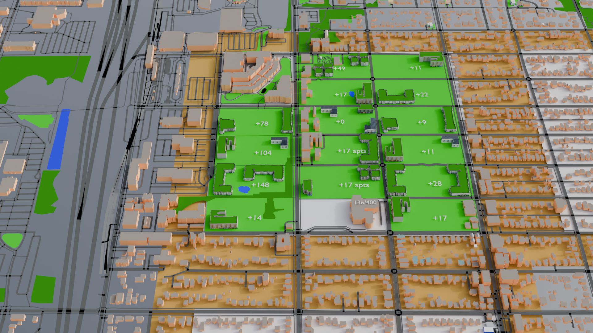
Unfortunately, that was the easiest part and only frees up only about a quarter, or maybe a third of our farm land. The rest of that zone is still covered with single family homes and some apartments. We’ll continue clockwise around the farm band and move people into the excess housing in the village. As before, each single family home is converted into 2 people who each get allocated 1.5 apartment or condo equivalents, and 20% of the people are assumed to be school age and enrolled in the school on the southern edge of the village (see the Phase 1 post if you want to see the math on all that). Because I’m getting more bang for my buck that way, I’m removing single family homes first and will leave any higher-density apartments where they are for the moment.
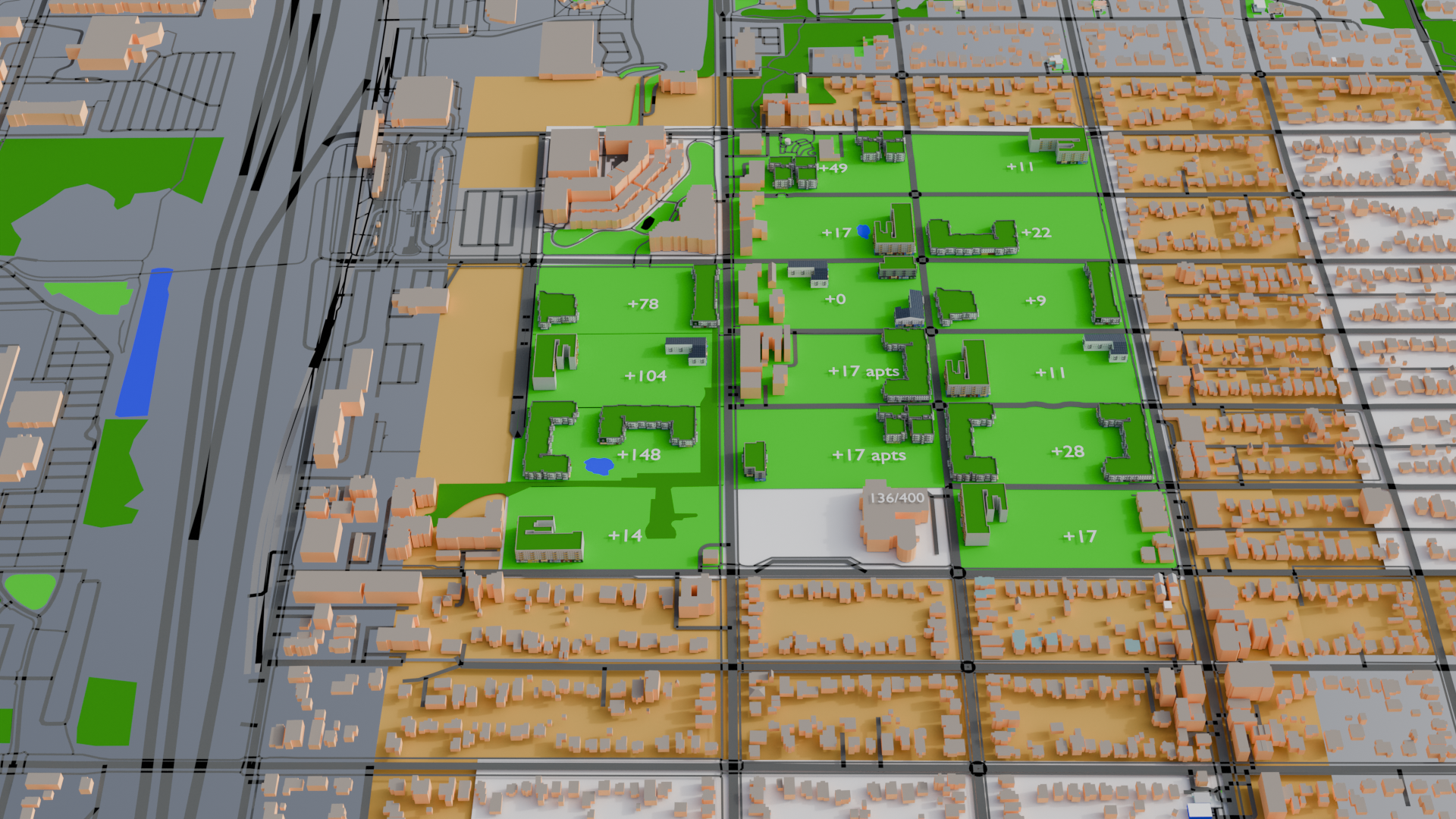
As shown in the image below, the excess housing in the village could nearly absorb all the single family houses in the farm band. A single block of houses, and a couple of small apartment buildings remain in the farm band when the current village housing hits capacity.
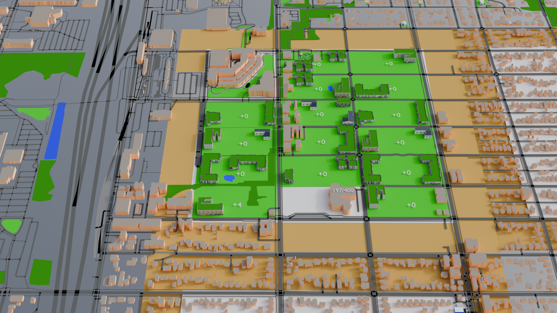
Building one additional larger or mid-rise condo building in the village, or two smaller low-rise buildings, will be enough to accommodate the remaining houses in the farm band. I’ll opt for the latter for a little variety, and the farmers can get to work. And every resident of the village is no more than about two blocks from farmland, in addition to having a park just outside the building they live in.
In the next phase, I’ll tackle transportation.