
I know the transportation part of this is not going to be particularly visual. If you saw Phase 1, you’ll know I imported a chunk of Seattle into Blender with Blosm. It imports transportation information as 1-dimensional lines that have some width applied to them based on the type of road or path. These uses/types of path are grouped into sometimes surprisingly fine divisions, like footway (sidewalk) vs. pedestrian area (car-free plaza or transit platform) vs pedestrian road (which I couldn’t find an example of) vs. stair steps. If I combine and simplify, I get the following groups:
- cycleway and footway (both 2m wide)
- railway (6m wide)
- carway
- motorway–freeway, or regional distance travel (10m)
- primary, secondary, and tertiary roads–generally used for in-town distance travel (9, 8, and 7m)
- residential streets–usually two lanes or effectively one lane plus street parking (also 7m)
- service roads–single-lane alleys and low-speed lanes in parking lots (4m)
With people and daily-needs businesses being closer together–indeed, often in the same building–there will be a drastic decrease in the need for driving a car lots of places. Many car trips will simply vanish because to get groceries you might just have to cross the street, not travel a mile.
The need for cars can also be decreased with a detail from the original Edenicity plans by ensuring that the middle of each village area has a nice transit stop. That means everyone lives less than 3 blocks from a bus stop. And here, we need to zoom out.
In Edenicity, the villages are organized into larger groups called “towns,” made up of 24 villages and 1 village-sized “town center.” In the image below, the town center is marked in red (the real-world location of North Seattle College.) With everyone in each village close to their village bus stop, everyone is well serviced by transit using only 25 stops per town. The idea being that you’d catch the bus and in just a few minutes you’d be at the town center. There, you’d find larger-scale services like perhaps a hospital, some office buildings, and longer-distance transit.
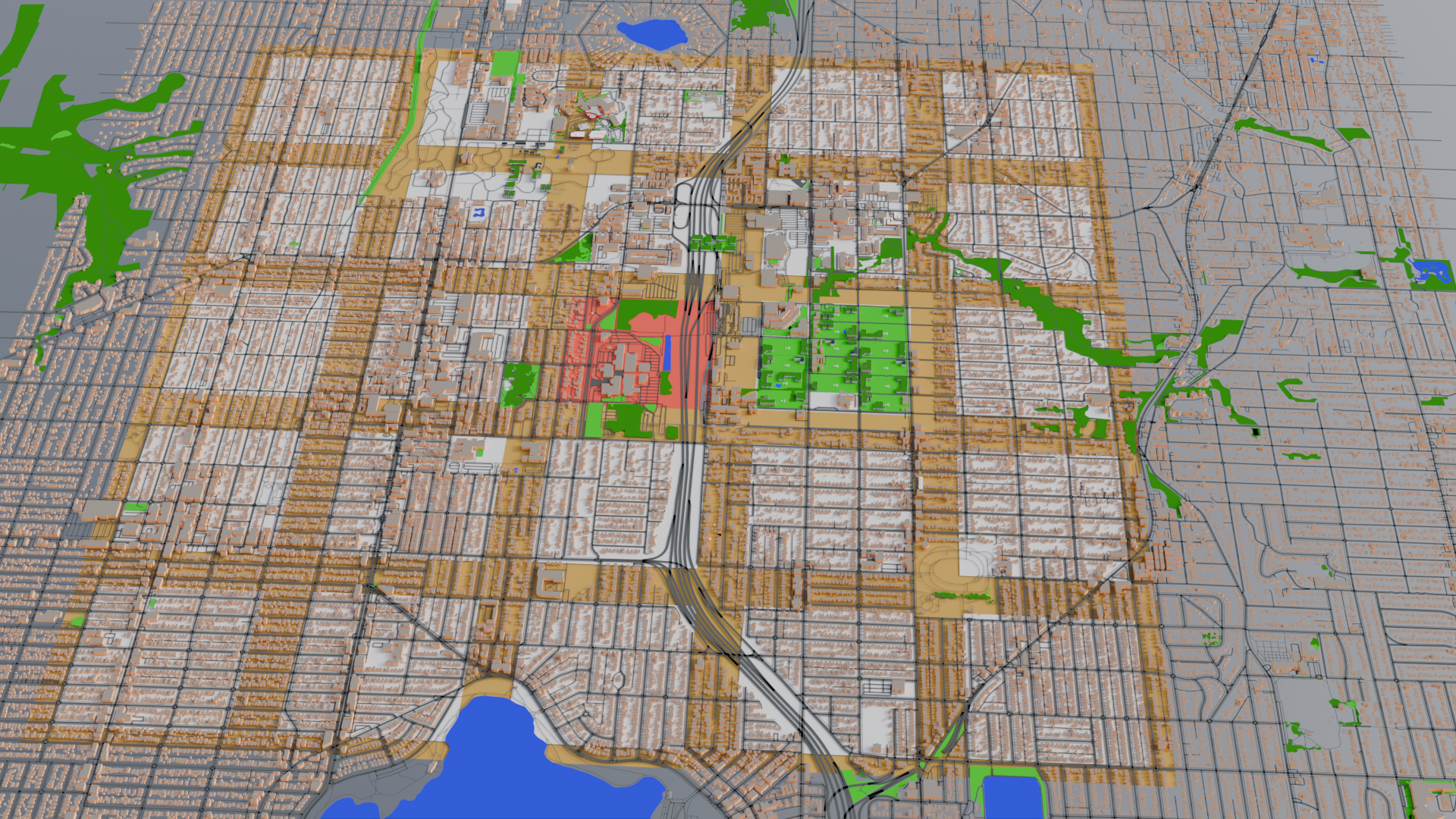
In my scenario here, people would bus to the college campus area. The bus part of the transit hub is along the northwest corner of our first converted village, and the light rail connection at the corresponding northeast corner of the red town center area. From there, anyone in this entire town can catch two types of public transportation to other parts of the city (ostensibly organized in a similar way).
All of this means transit becomes faster and more convenient for more people in this area than it is today, which also reduces the number of car trips.
With both fewer car trips needed for daily needs, and increased availability and speed of transit, the capacity of roads can be decreased.
Going back to the list at the beginning of this post, the existing paths for cycles, pedestrians, and rail are kept as they are for the time being. However, the first three types of carways (freeway, primary/secondary/tertiary roads, and residential streets) get shifted down one level. Freeway -> primary -> secondary -> tertiary -> residential -> service. To use examples from this area, it would be I-5 -> Aurora or Northgate Way -> Greenwood or 85th or Greenlake Drive -> 80th St / 15th Ave NE -> residential and service roads. In most cases, it’s shaving a meter off each type of road–slightly narrower lanes, or converting one of multiple lanes into green space.
The largest change would be tertiary and residential roads (7m wide) into service roads (4m wide). These all become more human/pedestrian in feeling, though cars could still make their way through if needed. Much like the experience of mixed pedestrians and cars in a current parking lot, both would be on more even footing with each other.
These changes aren’t very visible on the model, but on the ground would make everything seem just a bit safer with less car-frenzy. The “loss” of 3 meters in tertiary/residential road width can mean conversion to bike lanes and footpaths, which by default are only 2 meters. The primarily residential roads in the villages might look like a narrow, alley-sized local-access-only car road alongside a solar-panel covered, separated bike-and-pedestrian road.
The change also increases opportunities for those with mobility issues by reducing average car speeds, car volume, and the number of lanes that need to be crossed, and increased emphasis on pathways with no cars (bike and pedestrian). No doubt there would still be occasional challenges depending on individual circumstance, but providing many more options improves life for everyone, not just drivers of single-occupancy vehicles to the exclusion of everyone else.
No doubt there would be knock-on health effects, too. More people getting outside a little more often, a little less air pollution, some extra exercise…maybe even seeing and getting to know your neighbors for a bit of social cohesion. But all that is more about behavioral choices than zoning and infrastructure, so I won’t spend too much time on that.
A note about density
In the previous phases of this experiment, I wanted to see if you really could replace all those blocks of single family homes with park and farm land as Polk set out in Edenicity. Using the averages as assumptions described in Phase 1 you totally can. It frees up a lot of space if people are in higher density housing and private gated lawns are turned into public community areas. However, Polk’s arrangement is even more dense than mine.
That first village that I modeled has a population of somewhere between 1500 and 2000 people, or about 100 apartment equivalents per block, give or take. As a reminder, when the housing is at capacity it looks roughly like this.
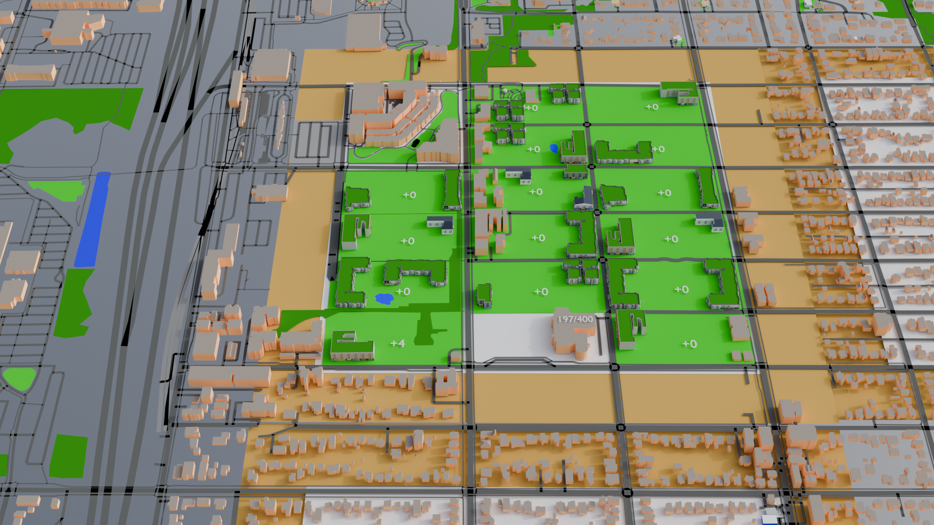
That’s usually two reasonably large apartment or condo buildings on each block. Some of the buildings I used there are four floors of residential with ground floor retail. Apparently three floors total (retail+2 residential) is considered low-rise, while 4 to 12 floors is considered mid-rise. I’ve used a mix of both in this first village. In the original Edenicity plan, though, Polk opted for more buildings but keeping everything low-rise. One of his default blocks is set up like this:
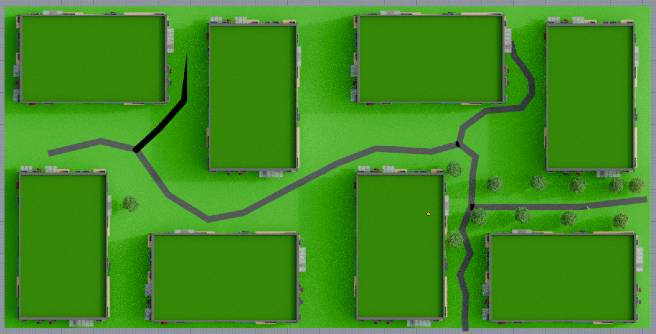
This block, continuing to use my previous assumptions would be 432 apartment equivalents. (Remember, my assumptions give 1.5 apartment equivalents to each resident of single family homes that get converted, and each apartment equivalent is about 25% larger than the current average Seattle apartment, so everyone’s still getting more space in their home than they had before.) These 8 condo/apt buildings would house the equivalent population as 144 single family homes.
So far so good, but what is it like outside the buildings? A very quick look from ground level, looking north from the block in the southwest corner of the first village in my model with fewer buildings. I haven’t added trees or any park landscaping, but you can get a sense of scale with the buildings and locate the pond on the larger views of the village.
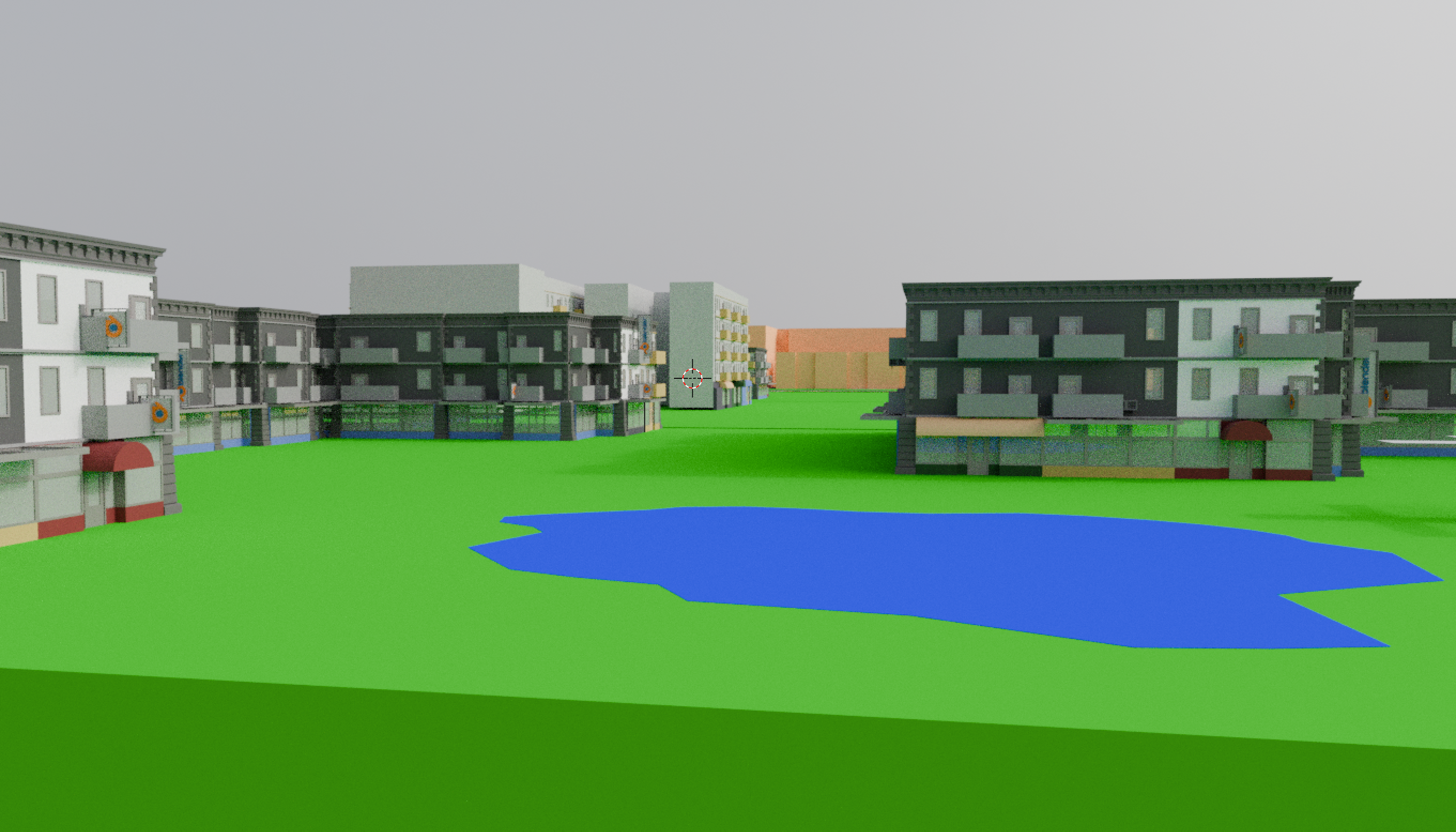
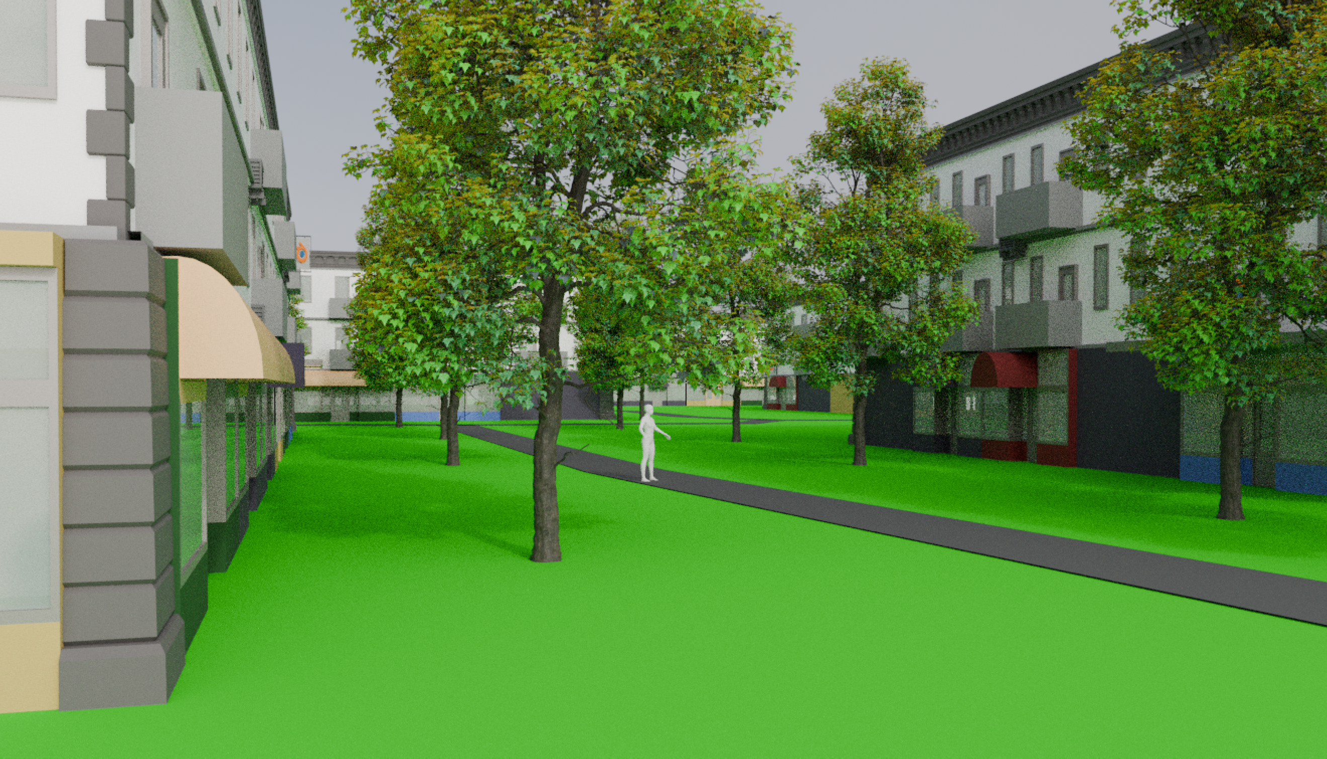
And for comparison, Polk’s denser version from ground level. In this case, I did add some trees and a blank human figure for scale. To me it feels kind of like a grassier version of Seattle’s Pioneer Square in terms of density. Still pleasantly spacious, but definitely more urban.
This still feels better to me than most city blocks in Seattle to me. For efficiency, I’ll keep my first village as-is, but base the blocks of the rest of the villages on this layout. The modeling of the initial village helps me know that this level of density isn’t needed yet in terms of housing everyone, so I’ll fill up buildings as I need them.
Next stop: the entire converted town with all these transportation and building changes in place. (If this were a video, the sped-up footage of me converting 23 more villages would play…)